
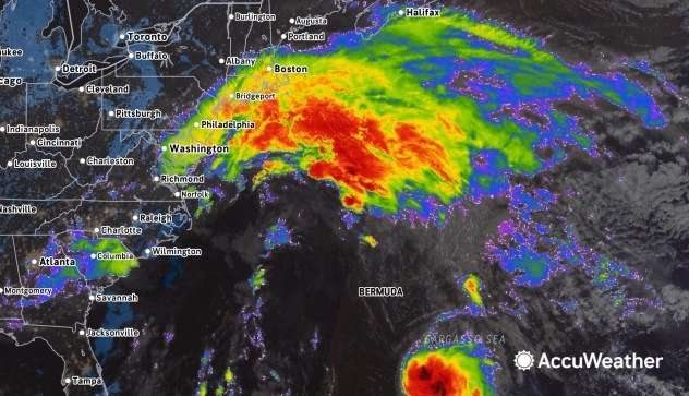
Heavy rainfall and winds are expected to bring significant flooding and coastal storm surges to the US East Coast this week as a tropical wind and rainstorm moves northward before dissipating into the Atlantic. The storm’s impacts will be felt from eastern North Carolina to southern New England, particularly over the weekend and into Monday night.
The storm’s unique structure spans nearly 1,000 miles, stretching from the Carolinas up to southern New England and eastward past Bermuda. Due to its size, some localized effects may lessen, but many coastal communities will still experience severe weather, including rain and substantial storm surges.
A primary concern is the anticipated storm surge, particularly during high tide cycles, which could potentially flood multiple neighborhoods along the coast. New Jersey has already declared a State of Emergency in preparation for the storm’s impacts. Onshore winds are forecasted to push water toward the Atlantic coast, with surges expected to reach 2-3 feet in many areas, and potentially up to 6 feet in localized spots.
Notably, the storm’s predicted peak tides in locations like Cape May, New Jersey, could reach as high as 8.4 feet, close to previous records established during significant storms. As a result, vital access roads could be submerged, and saltwater could damage vehicles caught in the flooding.
Wind gusts are also anticipated to reach 40-60 mph, with isolated gusts potentially hitting 80 mph, leading to tree damage and potential power outages for thousands of customers. These winds may also affect travel, resulting in numerous flight delays and cancellations along the eastern seaboard.
Rainfall amounts are projected to be significant, with some areas in the Carolinas potentially receiving 8-10 inches, leading to urban flooding, further exacerbated by the combination of storm surge and heavy rain. By early next week, the storm is expected to move out to sea, allowing communities time to assess damage and begin recovery efforts.
Small craft operating offshore will face hazardous conditions, with waves expected to reach heights of 20-25 feet, posing risks for larger vessels as well.
This weather situation exemplifies the unpredictable nature of tropical systems and their capacity to inflict severe weather impacts, regardless of their official classification by meteorological services.