
As Thanksgiving approaches, a significant storm system is expected to impact Michigan, with parts of the Upper Peninsula already starting to experience its effects. The storm will reach most of the Lower Peninsula by Wednesday, bringing a combination of rain, snow, and strong winds, which will severely affect holiday travel across West and Mid-Michigan, as well as Southeast Michigan.
The forecast indicates that rain will transition to snow by midday on Wednesday, with lake effect snow likely pushing inland by the afternoon. Early morning temperatures in the 40s are expected to drop to 32 degrees by late afternoon, and then settle in the upper 20s. Wind gusts could reach as high as 60 mph, especially along the Lakeshore, increasing the risk of power outages.
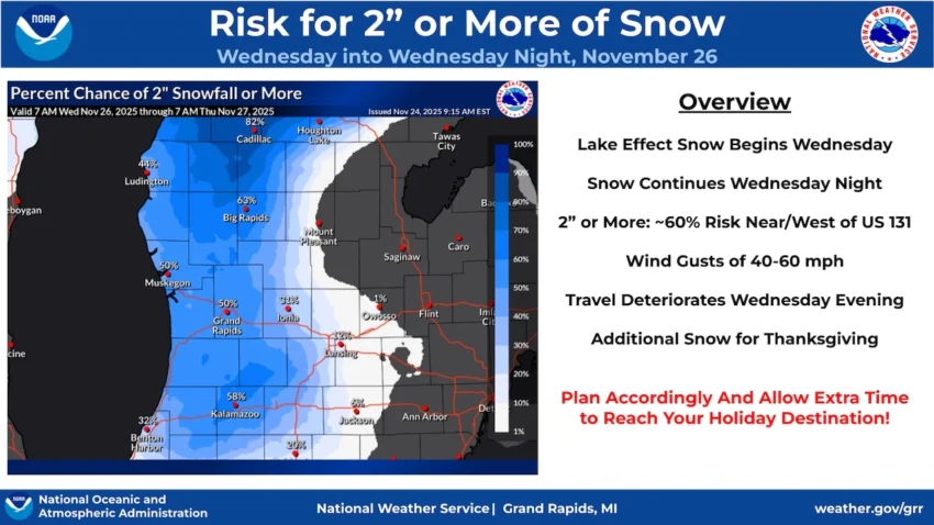
Travel conditions are expected to worsen by Wednesday evening as snow accumulates, particularly in areas near and west of U.S. 131, where over 2 inches of snow could fall. In Southeast Michigan, rain will give way to heavy, wet snow, especially along the I-94 corridor from Ann Arbor to Detroit, potentially accumulating up to 3 inches by Thursday.
Snowfall is anticipated to continue into Thursday, further impacting travel plans.
For updated weather information, consult the National Weather Service.
More details about the impending storm can be found in articles about the Thanksgiving Week Storm Timeline and the winter storm watches issued for the area.